GIS: Geographic Information Systems
The Geographic Information System (GIS) is a digital mapping and information management platform used by organizations worldwide to record and analyze the locations of their assets and associated data to support decision-making. In utilities, GIS is a key tool for spatially visualizing the as-built state of their service networks, including distribution and transmission. It is used to manage and maintain assets, enhance field safety, communicate with internal and external operators, stakeholders, and customers, and support reliable utility operations and customer service. When integrated with other enterprise systems, the GIS serves as the data marshalling system to provide the as-operating view of the utility’s networks.
Core Functions
GIS is the system of record for spatially referencing as-built utility assets.
- Capturing Asset Data Spatially and Digitally: This GIS framework is used for collecting and maintaining vector, raster, and tabular data on utility assets, their attributes, and related features.[1]
- Network Information Management: The ArcGIS Utility Network (UN), Esri’s next-generation GIS for utilities, creates a connected view of the utility network and enables native tracing. UN is built for network management, analysis, and planning.
- Asset Management: Assets can include anything of value (for utilities, this can include things like pipes, poles, transformers, meters, substations, and hydrants). The GIS supports utilities to understand:
- What and where are the assets
- How are they connected
- What is the condition of the asset
- How are they related to the customer
- What is their function in the network
- Compliance, Safety, and Risk Management: To ensure compliance and safety for all stakeholders, utilities rely on GIS.
- Displays hazard locations, so the field crew can reach the affected area quickly
- Supports emergency communications and coordination
- Standardizes inspections and tracking of maintenance for assignment
Ties inspections and maintenance to the location where work needs to be done[2] - Enables digital data collection for related assets and reporting
- Enables compliance reporting views for all stakeholders
- Transmission Corridor/Line Siting
- Visualizes routes and alternatives for presentation to stakeholders
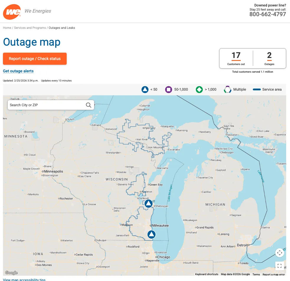
- Outage Management and Communications: When integrated with the utility’s outage management system, GIS can show where an outage is, communicate how long it will last, and indicate when service is expected to return by sharing the ‘outage map’ or dashboard via web browsers. Internal outage views (those not shared outside the utility) can be configured to include much more granular details, such as all outage events, all crews, their distance from the event, and time to make safe.
By connecting the GIS to the customer information system (CIS), utility customers can receive push notifications via email, text, or an app about related status updates. For gas companies, integrating with SCADA, AMI, and modeling systems and incorporating Artificial Intelligence/Machine Learning (AI/ML) can support robust incident command and provide historical referencing.
Key Benefits
- Better Decision Making: Visualizing the utility’s as-built network and performing complex analyses enables organizations to get quick answers, leading to better-informed, more efficient decision-making.
- Improved Safety and Regulatory Compliance: Knowing where things are helps reduce the safety risk window by enabling faster response to affected areas (for customers and field crews) and supports regulatory compliance activities. Consistent inspections and maintenance tracked within the GIS help mitigate incidents and meet compliance.
- Traceable Network: GIS provides a connected view of the network and the ability to trace it, supporting advanced network management applications.
- Outage Restoration: GIS supports outage communications to facilitate effective restoration coordination. This increases overall customer satisfaction.
- Supply Chain Management: When integrated with graphic design and EAM, GIS enables accurate material estimates to inform supplier management, purchasing plans, and material price negotiations. Provides more accurate lead times for required materials, resulting in more realistic project timelines for the utility and its customers.
- Capital Planning and Maintenance Paradigms: Forecasted, periodic, condition-based, and reliability-centered maintenance are supported by geospatial capacity, which provides asset and cost optimization, reduces downtime, and mitigates equipment failures, ensuring safer, more reliable service. CAPEX Portfolio Optimization can be enhanced by incorporating location and environmental data from GIS.
- Collaboration: The GIS provides a framework for integrating information and visualizing assets and their relationships in the physical world. It provides the connections that enable collaboration across the organization.
Integration with Other Systems
GIS is effective on its own, but it can unlock more opportunities for utility automation and advanced analytics when its data is integrated with other technologies. When integrated with key operational systems, GIS and its dashboard capabilities can be leveraged to support customer reliability, power quality issues, outage trends, and feeder reliability analysis. For successful integration, GIS data should be up to date and prepared. Some common integrations of GIS with other utility systems include the following:
- ADMS: Advanced Distribution Management System
- AMI: Advanced Metering Information
- CIS: Customer Information System
- DERMS: Distributed Energy Resource Management System
- DPS: Distribution Planning System
- EAM: Enterprise Asset Management
- Engineering Simulations
- FSM: Field Service Management
- OMS: Outage Management System
- SCADA: Supervisory Control and Data Acquisition
- Vegetation Management
Considerations
- Data Governance: Who gets to see what information?
- Data Quality: Many other systems and applications, including ADMS, reliability analysis, risk analysis, integrity, compliance, mobile, and outage management, are supported by the utility’s GIS. Therefore, the GIS data should be of sufficient quality to maintain connectivity in the GIS network and include the required attributes for optimal performance and communication.
- Digital Data Management: Data quality isn’t always there when paper maps have a lot of hand-written information and manual processes are in place. The more digital the utilities are, from design through construction to as-built, the better and more current the information and the easier it will be to solve problems using GIS.
- GIS In the Field: Field inspection tools need to be easy for field workers to use to ensure adoption.
Outlook
Enterprise GIS is increasingly important across all utility lines of business. This is due to its locational power, especially when planning work, and its ability to provide configurable views that address almost any use case.
More utilities will invest in enterprise capabilities vs. customized, and often expensive, point solutions. Requirements for data connectivity and system interoperability will also drive broader use of the enterprise GIS as an integration framework.
AI/ML will be incorporated into the GIS stack to help collect imagery, validate GIS assets, and perform imagery-based inspections.
Job design will be integrated with GIS, mobile as-built, and construction web apps to enable a fully digital workflow for validating network designs and energization. This creates the proposed and as-built views, along with integrations for ‘zero data latency’ in the ADMS network model.
GIS will continue to grow in importance in supporting grid management and gas operations. GIS service providers will innovate and extend GIS to forecast loads based on weather and to generate customer demand pricing. GIS will be used to publish views of gas pressure systems and operating models, creating a mimic board of real-time natural gas operations.
Summation
GIS is used to analyze unique data layers on a map and helps maximize and manage infrastructure assets by capturing information from installation through its lifecycle to retirement. This information is used to support organizational decision-making on an ongoing basis. For utilities, GIS is key to connecting the organization from the office to the field to its customers. It is instrumental in providing ‘location’ for the everyday management of energy delivery.
Footnotes
1. Assets: The managed, physical object; Attributes: Information about the feature; Features: The map object (location/shape). “Explain GIS assets, attributes, features” text generated by Google AI, Feb 10, 2026, https://google.com/.
2.“Ties inspections and maintenance to the location where work needs to be done”. Supports transmission line corridor management through a GIS application that manages transmission line O&M work, vegetation management work, and communications required for work performed close to transmission lines.
Related Items

GIS and the Pipeline Safety Act
Learn how your gas utility can apply GIS technology to meet the new safety requirements outlined in the Leonel Rondon Pipeline Safety Act.


GIS Data Governance for Improved ADMS Results
Providing quality data, including from the GIS, is essential to support each ADMS application and integration and in many cases is required.


Priority Index for Transmission Asset Management
Applying a Priority Index in UN can help transmission utilities convert siloed asset information into actionable data, turning the GIS into a decision engine.